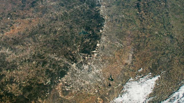
There’s been plenty of conversation around using AI in writing and art, but researchers in China have evidently brought machine intelligence to spaceflight. An AI was allowed to control a satellite’s camera for a full day, during which time it took photos of different locations on Earth—and it chose targets for reasons that eluded the researchers.
According to a report from the South China Morning Post, researchers controlled the Qimingxing 1 satellite with a ground-based AI system, as detailed in a paper published in the journal Geomatics and Information Science of Wuhan University. The research team is a part of the State Key Laboratory of Information Engineering in Surveying, Mapping and Remote Sensing, and the goal of the experiment was to determine how artificial intelligence might help streamline Qimingxing 1's Earth observation workflow through enhanced selectivity of different locations on the planet.
In other words, they’re trying to make Earth-observation satellites smarter and more efficient, so as to prevent them from aimlessly capturing troves of images that require copious amounts of processing back on Earth.
During the test, the AI autonomously chose areas on the surface to survey and capture images, but as the Post points out, the research team is unclear as to why the AI selected the locations it did. One of the areas that Qimingxing 1 reportedly targeted was Patna, a city in India situated along the Ganges River. It just so happens that this area is home to an Indian army regiment, one that clashed with China’s military in 2020, according to the Post. Another location imaged by the AI was Osaka, a major metropolitan area in southern Japan, but also an area that “occasionally hosts US Navy vessels operating in the Pacific,” according to the Post.
It’s entirely possible that the AI was trained to spot military-related targets, and that this technology could eventually be leveraged for surveillance purposes. As the Post points out: “The team suggested that an AI-controlled satellite could alert select users – including the military, national security administration and other relevant agencies – if it detected unusual objects or activity.” That said, it’s now common for AI to produce results or exhibit behaviors that lie outside the designers’ comprehension. I’m not saying that’s a good thing, just that it’s a thing AI developers are increasingly having to deal with—an issue known as the black box problem.
And while this report of an AI-controlled satellite may be as interesting as it is anxiety-inducing, the Qimingxing 1 test is a far cry from having satellites zoom around low Earth orbit with computers as pilots.
“I think it’s important to distinguish between ‘turned the direction the satellite was looking so it can take a photo’ versus ‘changed the orbit of the satellite, which could cause it to crash into somebody else.’,” said Jonathan McDowell, a spaceflight expert and astronomer at the Harvard-Smithsonian Center for Astrophysics, in an email with Gizmodo.
McDowell also expressed his concern over the use of the term “artificial intelligence” in this context.
“As for calling this software ‘AI’, I think the term is now being used so broadly that it loses any real meaning, and certainly doesn’t in these cases correspond to the popular concept of artificial intelligence,” he explained. “What is the AI-ness of the Chinese satellite control software, exactly? Is there really any, or is it just a regular computer program?”
Equipping a satellite with artificial intelligence for Earth imaging tasks is actually nothing new. Last fall, Italian company D-Orbit and Swedish startup Unibap collaborated on the ION satellite carrier, which used Amazon Web Services’ machine learning software to process and transmit images from space. Similar to this experiment, it was done to streamline the Earth image-capturing process by leveraging information technology.
For now, it would appear that we’re safe from a rogue AI piloting a satellite on its own volition. And for sure, this tech might eventually be integrated into a spy satellite. For now, however, it’s enough to say that it’s an advancement that could help scientists on missions to study our planet.
For more spaceflight in your life, follow us on Twitter and bookmark Gizmodo’s dedicated Spaceflight page.
"control" - Google News
April 18, 2023 at 03:15AM
https://ift.tt/rg8kh5W
Chinese Researchers Let AI Control Earth-Observing Satellite - Gizmodo
"control" - Google News
https://ift.tt/5nyMU91
https://ift.tt/4pjkP2i
Bagikan Berita Ini


0 Response to "Chinese Researchers Let AI Control Earth-Observing Satellite - Gizmodo"
Post a Comment