Amid the scorching heat, the itchy masks, the steady drum of politics and other perks of the pandemic, there’s virtually no place to escape to.
A trip to any favorite and fairly obscure place to get outdoors, lower your mask and raise your spirits is packed with people all with the same idea.
Anyone who’s made a recent trek to just about any of the nearby, regional trails, hikes or formerly quiet destinations can tell you those places have now become what everyone’s trying to get away from. Blame it on the population boom along the Front Range, more active inhabitants or the COVID cabin fever, but even weekday trails and outlying fourteeners are crowded places.
Here are a few destinations that rival the trends, at least for a few days until everyone gets the same idea. These respites are sometimes astonishingly remote and beautiful or hidden gems in the middle of the metro chaos.
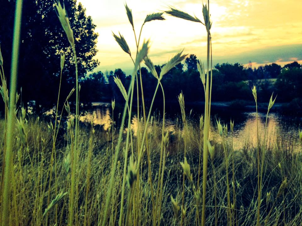
Loch Lamond
When I was a petulant teenager, armed with a driver’s license and my parents’ 1968 Chrysler Imperial, no peak nor path was too daunting, nor too crowded to conquer with a day pack or a backpack.
But even then, Saint Mary’s Glacier was almost guaranteed to be teeming with tourists who snapped Kodachromes grinning in front of an actual glacier before they nervously drove to the top of nearby Mount Evans to brag about waving from 14,0000 feet above the ocean coasts.
Thanks to global warming, the glaciers, Colorado style, are almost gone, but the incessant Saint Mary’s crowds have prevailed. What most folks then and now don’t know is that if you skip the parking lot and crowds there and keep driving up the dirt road, above the lake at Saint Mary’s, you can hike up to Loch Lamond and a few other stunning thin-air pools.
These days, the tough-road is open up to about a mile before the base of the glacier that creates the small, shining lake, which relatively few people seem interested in exploring. The region is high, but low enough to allow even recent lowland transplants to plod along the goat paths and marvel at one of the state’s most endearing and endangered qualities: alpine bliss.
Crowds and the googles, like Alltrails.com have made this once alluring trek move toward the overused list. But early on weekends and during the week, there’s still a sense of wondrous privacy on the loch while everybody else goes to bag their ‘teeners.
Your reward? Alpine flowers, a trickling waterfall, all that’s left of the glacial formation, and plenty of lofty walking to clear your mind.
— Dave Perry, Staff Writer
GETTING THERE: From I-70 westbound, take Exit 238, the Fall River Road. Drive that pretty, winding road about 8 miles to Alice Road. Make a left. Follow Alice Road until you can turn right on Steuart Road. The road to the lake is now closed. Park before the gate and make the mile-or-less trek up the road.
Settler’s Park in Boulder
This isn’t necessarily much of a “secret” location, but it’s a less crowded alternative to the Flatirons, Boulder’s main tourist attraction. Nestled on the edge of town near Boulder Creek, Settler’s Park is a quiet piece of open space in Sunshine Canyon with a range of trailheads branching off from it. Available hikes vary from relaxing strolls, including areas that are accessible to people in wheelchairs, to more strenuous routes. The red rocks trail takes you through a series of beautiful natural rock formations and offers an aerial view of much of downtown Boulder. The park is within walking distance of Pearl Street Mall, which currently has expanded street walking space and outdoor dining. Parking may be limited at the trailhead and bathrooms are not available. Leashed dogs are allowed, bicycles are not. All visitors are required to wear a face covering.
— Carina Julig, Staff Writer
GETTING THERE: Take I-225 N to I-70 W, then merge onto U.S. 36. Take the Baseline Road exit in Boulder and then take Broadway to Boulder Canyon Drive.
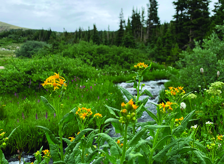
Elaine Valente Open Space
Nothing says unmatched urban tranquility like — Thornton. Don’t scoff. Here’s what many don’t know. The lowly South Platte River is bordered by a concrete ribbon that can get you from Chatfield Reservoir south of Littleton all the way north to the outer reaches of metro suburban civilization. Mostly flat, serious bikers can rage along the private highway early in the morning and late at night. Prissy pedalers can meander for miles without tiring.
From Downtown Denver north, the Platte and Clear Creek trails are dotted with oddly remote and lush pockets nestled among Interstate on-ramps, power generators, sewage plants and other industrial highlights.
Pedal north. Go beyond the stunning confluence of the aptly named Clear Creek and the plodding Platte. Keep going into Adams County, where old and new gravel ponds have taken on new life as pristine lake-lets usually bothered only by a few dog walkers and determined strollers.
The area between Commerce City and Henderson has become a virtual bird sanctuary along this slow and winding part of the Platte. Owls, raptors, pelicans and cranes haunt the area where you would least expect them.
Keep going, past the county’s new water storage facilities and rehabbed paved trails, just beyond East 104th Avenue. Ride under the bridge. A small lake with two docks is surrounded by ancient cottonwoods and elms. The east side of the lake is almost always barren of people. The lake itself is ringed with cattails that provide cover for a variety of birds and eerily aggressive fish.
If you’d rather have teeth pulled than bike in Colorado’s therapeutic desert August heat, you can drive to the west side of the lake and park. From the lake, you can walk south along the South Platte Trail back toward other ponds and a wooded levee area frequented by deer, fox and a variety of very large and entertaining rodents.
— Dave Perry, staff writer
GETTING THERE
BY BIKE: If you’re really serious, you can ride the Sand Creek Trail from Aurora to its confluence at Commerce City, and on north. It’s a trek, but totally doable if you’re not in need of a stent. If you’re just serious, there are a variety of access points to the South Platte Bike trail along Downtown Denver, including the Denver skate park on 20th Street, or the new regional park at the mousetrap. Park near the Pepsi bottling plant in RiNo. Ride north, past the old Denver graveyard, past the Xcel Energy Plant, past the Clear Creek Confluence, about 12 miles. If that’s a drag, drive your bike to the parking lot/drop off at the Platte River Trailhead Parking Lot at East 88th Avenue and Colorado Boulevard. It’s an easy and satisfying ride from there, north to East 104th Avenue.
BY CAR: Take I-25 north to 104th Avenue. Drive east about 4 miles. The parking lot is on the west.
Benson Sculpture Garden/Lake Loveland
This attraction is a bit farther afield if you live in the metro area, but it could make for a nice day trip to northern Colorado if you’re looking to get out of the city. With the pandemic closing or limiting access to many art museums, the Benson Sculpture Garden offers a safe way to appreciate art outdoors. The 10-acre park has over 150 sculptures created by artists from Colorado and across the nation, and you can easily lose track of time taking in all of the different pieces of art. The garden is adjacent to North Lake Park and Lake Loveland. The lake is closed to swimmers for the season but is open for fishing.
— Carina Julig, Staff Writer
Getting there: Take I-225 to I-270 W, then merge onto I-25 N. Follow I-25 for 40 miles and then take exit 257 to merge onto U.S. 34 in Loveland. Take a right on Madison Avenue and a left on East 29th Street to arrive at 2908 Aspen Drive.
Heron Pond/Heller Open space
Delicately nestled next to a recycling plant, a quick jaunt to Heller Open Space and Heron Pond can be a nice escape from the city, without having to leave its limits. A ring of trees lines Heron Pond, which lies in the middle of the open space area. Heron Pond will occasionally play as a rest stop to birds, aside from the usual ducks, that aren’t necessarily regulars within the concrete confines of Denver, including prairie birds like Lark Buntings or Loggerhead Shrikes. The loop trail is 1.3 miles and can be walked in about 30 minutes. If you cautiously break from the trail on the east side of the pond, you’ll find a terrific view of the Denver skyline. The open space is located at 1401 E. 53rd Ave and is open 365 days a year.
— Philip B. Poston, Staff Writer
GETTING THERE: From downtown Denver, take North Broadway, which turns into the recently renovated Brighton Boulevard, until you’ve reached 38th Street. Turn left onto 38th Street, which becomes Washington Street. after crossing the South Platte River. Follow Washington until you reach East 54th Avenue, hook a right and there you are.
Prefer to pedal your way ? Take the South Platte bike path from Confluence Park north to East 53rd Avenue.
Sand Creek Regional Greenway
Everybody loves Colorado’s mountains, but there’s something pretty special about the high plains and staying close to home. The Sand Creek Regional Greenway runs from Commerce City through Denver and finishes in Aurora. The space captures the best of what it means to live in the suburbs, on the prairie, tucked up next to the Rockies. There’s plenty of places on this 14-mile greenway where you won’t find a crowd for an early morning bike ride or way too many people when you need a moment of escape. Head to the Commerce City Wetlands Park, Morrison Nature Center in Aurora or the Bluff Lake Nature Center in northeast Denver for easy access to the main trail.
— Kara Mason, Staff Writer
GETTING THERE: The greenway’s website, https://ift.tt/34jxBxU, gives pretty extensive directions for any of the main spots along the trail you’re looking for. If you start in Aurora, find Sand Creek Park at the intersection of Peoria Street and Fitzsimons Parkway. From the parking lot, look for the trailhead that will direct you either east or west.
"crowd" - Google News
August 20, 2020 at 08:56PM
https://ift.tt/2YiNGjf
CROWD SORES: A few nearby places to still get away from it all - Sentinel Colorado
"crowd" - Google News
https://ift.tt/2YpUyMI
https://ift.tt/2KQD83I
Bagikan Berita Ini


0 Response to "CROWD SORES: A few nearby places to still get away from it all - Sentinel Colorado"
Post a Comment